Monday, 16 May 2016

COMMISSIONED ARTIST: LEXI BLAKEWAY


Let's say hello to Lexi Blakeway..

Lexi trained as a primary school teacher many years ago, took time out to travel and home educate her three children and live a sustainable life in self built yurts for a few years.  " Ive always created since as long as I can remember and have taught myself numerous crafts over the years particularly different ways of weaving materials together which is how I moved into felting a few years ago.  


I'm a Self taught felter, totally captivated by the versatility of wool and love the fact that I can move my work towards being totally locally sustainable.  I create textile pictures, cushions, bags etc from wool and various other fibres weaved in, and sculpt figures/animals with needles from the wool.  


 As one of the things that ties this project together is locally sourced materials I will be aiming to naturally hand dye as much of the wool as possible using plants local to the Lakes and planting a dye garden at my allotment.

INTRODUCING THE PROJECT: ALEX AND JOHN VISIT SIR JOHN BARROW

When we made the first of our  school visits to Sir John Barrow  we were a little nervous..would the boys and girls like our idea? Would they find it interesting and make something of their own from it?
We were hoping that each school would bring something different to the project, and that after an introduction from Alex and me, they would "take over" and surprise us with their ideas and knowledge of the town. We began by looking at the maps and aerial photos supplied by Alex, and then the group closed their eyes and traced the walk from school to Tesco in Ulverston town centre, passing over zebra crossings, shops, lampposts, cars, trees,houses and gardens...

We looked at the way these object and places are described using symbols and shapes on Ordnance Survey ( OS) Maps. Using strips of fabric, we marked out the main roads through Ulverston on our 4"X4" baseboard,and added the landmarks we had passed during our imaginary walk using appropriately coloured or textured pieces of fabric, paper and other materials. For instance, the pale blue plastic strip in the upper right hand area of picture below represents Ulverston canal..the piece of rolled fabric at top left is Hoad Hill and the Sir John Barrow Monument...and the Zebra Crossing  over the A590 speaks for itself.

So....we were very pleased by the way the session went. It was great to see so much enthusiasm, and to see everyone thinking and making suggestions .We left with lots of ideas, and  are looking forward to seeing the boys and girls again at the Coro.


Sunday, 15 May 2016

DAY TWO AT THE CORO: CHURCH WALK

We had another excellent day today, as you can see the Map is beginning to fill up.  Important  landmarks are being introduced and some really good colour and texture work has shown us the layout of town centre streets and yards in the bottom right.


We also met up with Fran and Lexi, two of the artists who are working on the project alongside the schools.  Fran and Lexi brought in some examples of their work and talked about how they might be going to make their pieces.   The boys and girls had some very good questions, and it was nice to see them talking to Fran and Lexi and looking at their work. They were made to feel very welcome and enjoyed seeing the boys and girls at work.  
We also listened to some of thesounds that artist Pete Dent has been recording around Ulverston for his piece.
                                                                                          

Lexi passed around some of her felted pictures and objects, and Fran showed us here sketchbooks and a montage of images from a walk she had taken around the area. You can see these on the right of this page.  Lexi plans to make a 3-d felted version of Hoad Hill, and will be using wool dyes made from plants that grow in our area.  The  boys and girls carried on working on houses, trees and field for the rest of the session , and at the end of the afternoon we looked closely at the aerial photograph  to see what still needed to be added to the piece.  In the next session the aim is to cover any areas of white board, and to show gardens, streets and any small details that seem important.   So, it's been another really good session, and thanks again from John and Alex for your hard work, and for helping to clear up the mess! 


Thursday, 12 May 2016

GREEN ROOM COMMISSIONED ARTIST: PETE DENT

Ulverston Sound Recordist Pete Dent has worked with John and Barrow Sound Arts company The Octopus Collective on several projects, including an installation for Barrow Park , a Sound Map of Millom and some Listening Posts for Natural England. 

Pete says:
For this project I want to explore the place I grew up, revisiting the sites of some of my personal memories and focus on the ambient sound of these areas. The sounds found in some of these places are instantly recognisable to me and have the ability to transport me to stories from different times of my life. Just as we are constantly creating new memories in our town I want to take the sound of Ulverston and manipulate to create a new audio tapestry.

Pete has provided three work-in-progress recordings from these sites...click the links below the images..


DAY ONE AT THE CORO WITH CHURCH WALK

We've just cleared up the tools from what was the first Green Room session at the Coro. Alex and me are both really impressed with what the Church Walk boys and girls have done today. We've heard lots of good ideas,  seen lots of ways of making trees , houses, roads and fields, and had a lot of fun.


The group divided itself into 4 teams, each making a different part of the map. Firstly we got the roads and lanes into position, and then added the first of the fields and green spaces while  the others were making houses and bits of woodland to be placed on the board. 
  It was great to watch the work begin to take shape, and to see people work things out for themselves. 
A lot of the materials came from the boys and girls themselves, which was very useful.  It was important to get the roads and lanes in place in order to get an idea of where the houses and fields were going to be.  The roads were laid out very carefully in black strips of cloth, and the lanes were made of bootlaces and wool. 

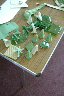
 Everyone seemed to be making careful decisions about colour, and texture and scale.  The people making trees were coming up with lots of  design variations, which was very good as there are a wide variety of trees in our bit of town.


 The housemakers used lots of colours to describe the houses on Soutergate, while  different shades of green were  used to make a  realistic- looking Ford Park.  We had time for a drinks break and a chat, and towards the end of the day we had a couple of visitors, Charlie from the Coro and one of the actors  from a visiting show called in to see what was going on, and were full of praise for the boys and girls and their work. 

At the foot of this page you'll see the piece of work as it was at the end of Day One...look out for an update tomorrow!! 


Monday, 9 May 2016

INTRODUCING THE PROJECT...ALEX AND JOHN VISIT CHURCH WALK SCHOOL

We're up and running after the first  two of three introductory sessions with our partner schools. We were at Sir John Barrow a week ago,  (photos to follow)  we'll be at Croftlands next month at we visited Church Walk last friday....
We talked to the boys and girls about the ideas behind Green Room, and heard about their own artwork. A very high number of boys and girls had family members who are artists and craftspeople, and several of the class are producing their own illustrated  books. This all bodes very well for our project, as we know people will bring their own ideas to the sessions.

We began by looking at the maps and aerial photos supplied by Alex, and then the group closed their eyes and traced the walk from school to the Market Cross in Ulverston town centre. Mrs Newby wrote down the landmarks that the boys and girls recalled as they recalled the walk.
Shops, lampposts, cars, trees,houses and gardens...we found could " see" the journey very clearly.

We looked at the way these object and places are described using symbols and shapes on Ordnance Survey ( OS) Maps. Using strips of fabric, we marked out the main roads through Ulverston on our 4"X4" baseboard.  Working solo and in groups and using patches of fabrics from the Scrap Store, we asked the boys and girls to make a map of  a part of town on the board.  We were really pleased when the boys and girls began to develop their own way of working. Without any nudging from us, they began to make small  maps  on the floor, sometimes using the painted white lines   as part of the work. 


We then asked them to place some elements of their work onto the baseboard. The results were a colourful and readable map of the town, with woodlands, the canal, and important building and landmarks clearly marked...here it is...


   Alex and I think this represents  a great start to our project, and we are looking forward to seeing the Church Walk boys and Girls at the Coro for the first session on the 12th of May.

Friday, 6 May 2016

From Alex: An Introduction to the history of maps.

What do we know about maps? How did we arrive at the system we now use to describe the landscape and the buildings and installations that it contains?  Alex has put together this useful bit of information about the history and language of mapping. 

Interpreting maps
Maps
A map is a symbolic visual depiction, illustrating the relationship between various objects or locations.

Usually maps are geographical,  geological or astronomical, but there are even maps of the brain.


People have been making maps for thousands of years & they may not look like the kind of maps we imagine when we think of maps.


The earliest known maps are of the stars, not the earth. Dots dating to 16,500 BC found on the walls of the Lascaux caves map out part of the night sky.

.Herodotus wrote a book called HISTORIES in 5bc. He divided the world into three continents Asia, Africa & Europe & he described all the peoples in the world he had heard of & the location of their lands relative to each other.
This is great for exploring the ancient world in your imagination, But not very good for getting around in the physical world.


 Maps, art & maths

Maps combine Art & maths, often very precise measurements of direction, length & height must be made.

In the past the tools for mapping were very easy to find but hard to use, Knowing the rising positions of stars can help you get accurate directions BUT the stars of the horizon vary between different times of the year & different countries & what if its cloudy?  So it was a very special skill.

Our star (the sun) will help us find east & west as it travels its daily course & it will also let us know what time it is.
These two facts Time & Direction will let you work out roughly how far you have travelled & to where.

 Old maps used many different systems of alignment. Old Japanese maps had the city of Edo at the top & aligning maps to the city of Jerusalem a popular choice for Christian nations.   

 Around 206bc in China, a device was developed which made navigation more accurate, called the Sinan, meaning south governor. This device became known as the Compass. A compass has a magnetised needle which, always tries to point towards magnetic north. Magnetic north is the point where the Earth magnetic field focuses directly downwards & this is very handily near the north pole (northern polar axis). With this invention there was always one direction you could always find day or night, in any weather & travelling far over the ocean & deserts became safer. Soon aligning maps with north to the top became the normal.
 Another way to orientate a map is by using the sun and an analogue wrist watch. If a person points the hour hand (smaller hand) on his or her watch towards the sun, south will always be half way between 12 and the hour hand. North will be in the exactly opposite direction of south.

  .The oldest known world map is on a clay tablet made by the Babylonian peoples of ancient Iraq in 600bc. Although its a symbolic map of how they imagined the world to be & doesn’t include countries they didn’t like !


 Ptolemy was a Roman Geographer who 150ad. He wrote famous books about Cartography or map making. The Geographia, a book about how to map the earth  & The Almagest, a book about the stars & planets. These books combined to set out his grand scheme.
He divided the world map up by grid & assigned a set of coordinates to each place or geographic feature .
This proved a very popular system & was still used in the 15th-century.


The word “Map” comes from the Medieval Latin name, mappa mundi, meaning cloth world, because some maps were painted on scrolls of cloth to make them easy to roll up & transport.


.Gerardus Mercator was a Flemish mapmaker who in 1569 realised that if you try to fit a squared grid map around a spherical earth, it stretches out of shape. So he developed a system of geometry to correct the distortion.
This was called the Mercator projection & was so far ahead of its time it took many years before people actually had the tools to measure distances that accurately, although it is a very widely used system today.


  Map symbols.
.Many different sets of symbols have been used as a kind of short hand to describe places of interest on a map.  People who create maps (cartographers) always try to draw symbols which resemble the feature that they are representing, So a camping ground may be a simple picture of a triangular tent or a old castle may be a tiny drawing of a castle.


The maps of the Australians Aborigines use a ancient set of traditional symbols called pictogram. Many of these look like what they depict. Some are harder to work out.


 Our Ordinance survey maps also use a set of traditional pictograms & often the bigger they are the more important the location they indicate.


 It has become a convention for certain colours to represent certain features. Blue for water, including lakes and rivers. Vegetation is often featured as green & sands in yellows.


Maps frequently have a special text box called the Legend, this has an explanation of what all the different symbols used on the map mean.

"Terra incognita or terra ignota". The Latin term for unknown lands has been used since Ptolemy to label areas of the map that have not been explored. English maps use the label Parts Unknown.
"Hic Sunt Dracones". The Latin for here is dragons wasn’t really used on maps very often & is thought to relate to the Komodo dragons of the Indonesian isles.
There are certainly some odd creatures drawn on maps. Arabic maps frequently drew there astrological monsters on maps as a aide to navigation.
Oddly "Hic Sunt Leones", (here is lions), was a very popular way of saying "we don't know what is here."
                                                    Ariel maps & texture.

Now we can use satellites on the edge of space to map the word in fine detail using remote sensing.

Different forms of Satellite imaging clearly show the different land usages over large areas, Satellite images have many applications. Meteorology ( the study of weather), geology, Cartography, conservation and , sadly, warfare are some of the uses.
In 1972 the USA started the largest program for  gathering imagery of Earth from space, called Land-sat Program.

GPS The Global Positioning System became available in 1995,  it is a Satellite Navigation system that provides location and time information in all weather conditions, anywhere on Earth.

         Different types of sensor record different information.
Some common passive sensors that satellite's use, are infra-red & radiometry. These are often given artificial colour schemes to assist in the interpretation of what we see.


 Another common passive sensor is Photography.
Photographed from space,the  earth becomes a mosaic of textures. the regular shapes of housing developments, contrast with the patchworks of fields & the smoky intrusion of the sea.


Alex.